
Fil:Wfm southampton island.jpg

Størrelse af denne forhåndsvisning: 800 × 593 pixels. Andre opløsninger: 320 × 237 pixels | 640 × 474 pixels | 1.024 × 758 pixels | 1.280 × 948 pixels.
Fuld opløsning (1.280 × 948 billedpunkter, filstørrelse: 144 KB, MIME-type: image/jpeg)
|
|
Denne fil er fra Wikimedia Commons. Beskrivelsen af filen fra Commons er gengivet nedenfor. |
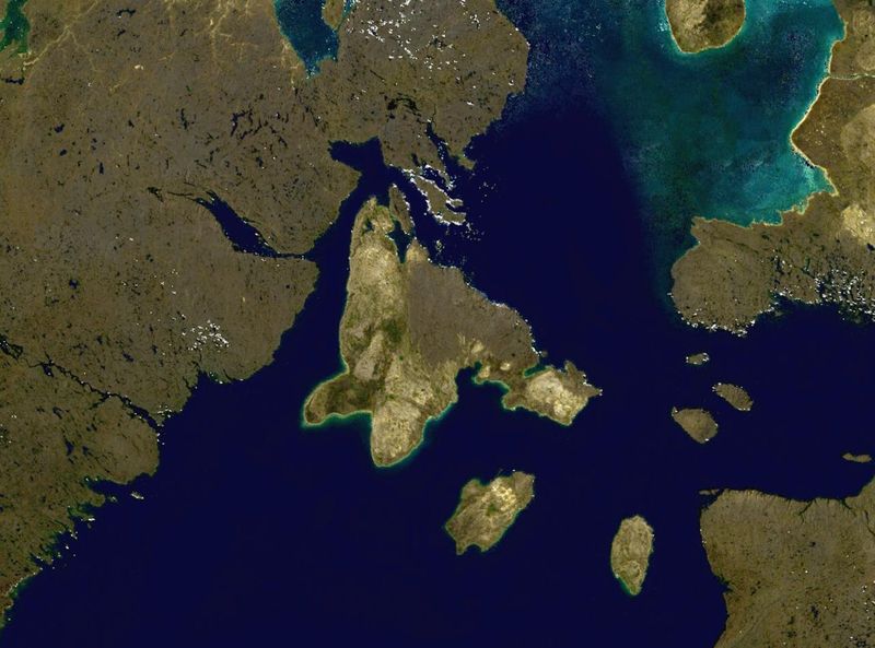
Southampton Island in northern Canada.
NASA blue pearl data, collected using NASA World Wind.
| This image is in the public domain because it is a screenshot from NASA’s globe software World Wind using a public domain layer, such as Blue Marble, MODIS, Landsat, SRTM, USGS or GLOBE.
|
 |
| Annotations | This image is annotated: View the annotations at Commons |
Filhistorik
Klik på en dato/tid for at se filen som den så ud på det tidspunkt.
| Dato/tid | Miniaturebillede | Dimensioner | Bruger | Kommentar | |
|---|---|---|---|---|---|
| nuværende | 9. apr. 2006, 18:02 | | 1.280 × 948 (144 KB) | Finlay McWalter | Southampton Island in northern Canada. NASA blue pearl data, collected using NASA World Wind. {{PD-USGov-NASA}} Category:Nunavut Category:Satellite images of islands Category:Satellite pictures of Canada |
Filanvendelse
Den følgende side bruger denne fil:
Global filanvendelse
Følgende andre wikier anvender denne fil:
- Anvendelser på af.wikipedia.org
- Anvendelser på ar.wikipedia.org
- Anvendelser på ast.wikipedia.org
- Anvendelser på az.wikipedia.org
- Anvendelser på ba.wikipedia.org
- Anvendelser på be.wikipedia.org
- Anvendelser på bg.wikipedia.org
- Anvendelser på ca.wikipedia.org
- Anvendelser på ceb.wikipedia.org
- Anvendelser på cy.wikipedia.org
- Anvendelser på de.wikipedia.org
- Anvendelser på el.wikipedia.org
- Anvendelser på en.wikipedia.org
- Anvendelser på es.wikipedia.org
- Anvendelser på et.wikipedia.org
- Anvendelser på eu.wikipedia.org
- Anvendelser på fa.wikipedia.org
- Anvendelser på fi.wikipedia.org
- Anvendelser på fr.wikipedia.org
- Anvendelser på ga.wikipedia.org
- Anvendelser på gl.wikipedia.org
- Anvendelser på he.wikipedia.org
- Anvendelser på hr.wikipedia.org
- Anvendelser på hu.wikipedia.org
- Anvendelser på hy.wikipedia.org
- Anvendelser på it.wikipedia.org
- Anvendelser på ka.wikipedia.org
- Anvendelser på kk.wikipedia.org
- Anvendelser på ko.wikipedia.org
Vis flere globale anvendelser af denne fil.